BUSINESS


Robust location based
custom-built solutions
TrackIt GIS Suite includes a series of modular solutions which deliver precise and current geo-address data from our team of GIS specialists to the hands of Non-GIS experts for easy analysis and data processing.
Watch Video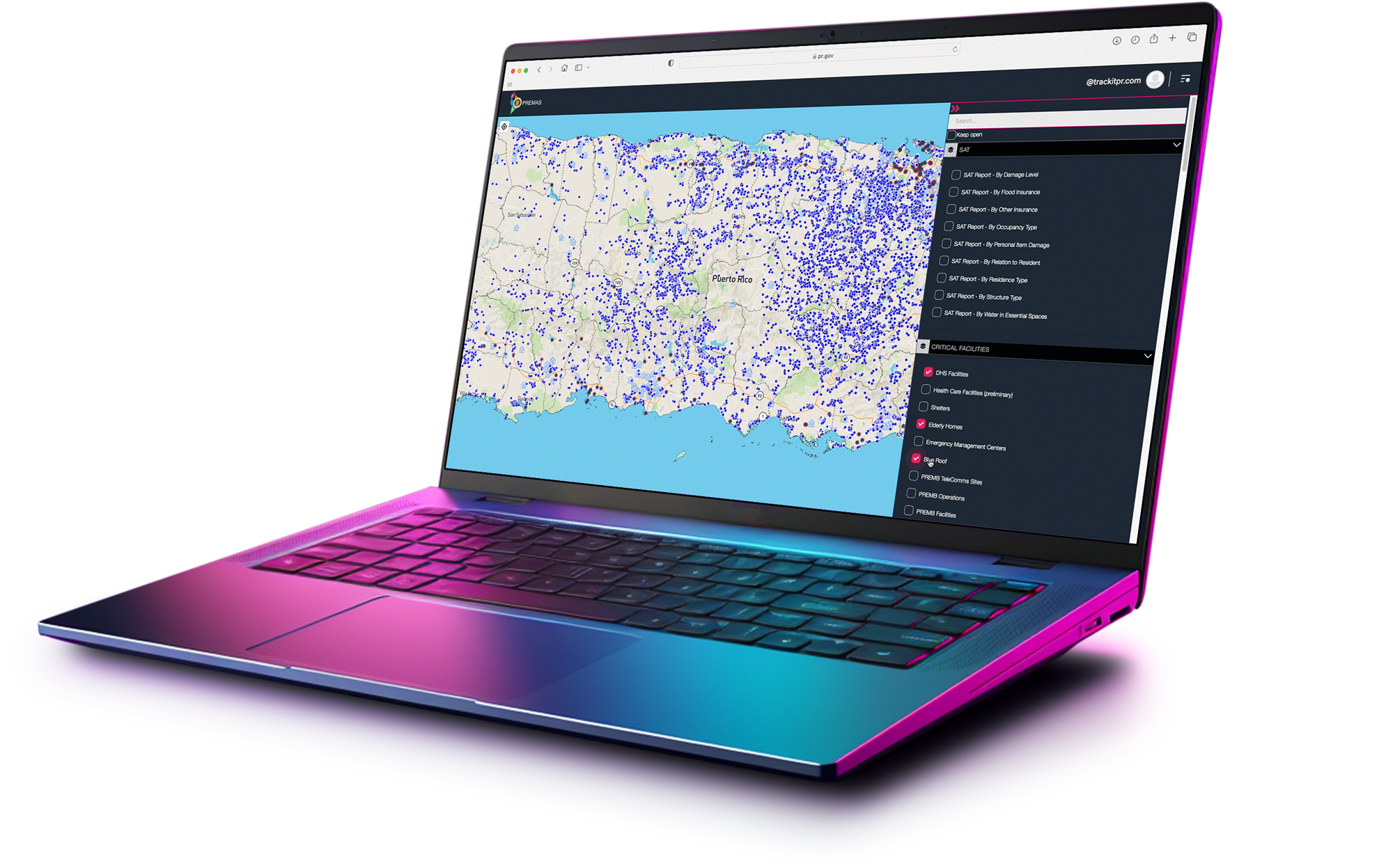
About Us
TrackIt, LLC is a minority and women-owned company, headquartered in San Juan, Puerto Rico. We specialize in providing geospatial support services and are recognized as one of the leading GIS analysis firms on the Island. TrackIt has a dedicated team of passionate professionals who provide technical support for the design, construction, and operation of state-of-the-art geospatial projects since 1994.
Read MoreOur Core Services
TrackIt, LLC provides several services to further support and expand the implementation potential of our GIS tools.

GIS
Consulting
Our GIS expertise will add value to your project at every corner of your decision-making process

Mapping
Optimization
We can optimize
open-sourced maps by updating them against
our proprietary data sets

Routing
Services
We specialize in digital routing solutions powered by our GIS
Data Suite modules in real-time.

Map
Validation
We have the most accurate Puerto Rico-specific GIS data sets in
existence to validate any unverified map.


OUR COMPETITIVE EDGE

PROPRIETARY
Our Geo-data sets surpass any other Puerto Rico GIS repository in existance in terms of precission and accuracy.

MODULAR
Our GIS Suite is divided into modular solutions in order to allow for easy tailored & scalable tools construction.

LOCAL
TrackIt is powered by a team of veteran GIS experts with vast experience in PR's geo-landscape.

Our Mission
At Trackit LLC, our mission is to revolutionize the geospatial industry by harnessing the power of leadership and innovation. As a women-owned company, we are committed to providing cutting-edge Geographic Information System (GIS) solutions that empower our clients to make informed decisions, enhance sustainability, and drive positive change in their communities. We strive for excellence in every aspect of our work, from technology development to customer support, all while fostering a diverse and inclusive workforce that thrives on creativity and collaboration.
TrackIt GIS Suite
A next-generation suite of modular solutions designed and developed locally in Puerto Rico by veteran specialists.
DISCOVER SOLUTIONSDISCOVER SOLUTIONS

The Puerto Rico Emergency Management Assets System (PREMAS) is a comprehensive, GIS-based decision-support platform designed to enhance situational awareness, improve response coordination, and optimize resource allocation during emergencies. Its architecture combines real-time geospatial visualization, secure data management, and interagency collaboration tools to provide an end-to-end framework for emergency management in Puerto Rico.
The Puerto Rico Emergency Management Assets System (PREMAS) is a comprehensive, GIS-based decision-support platform designed to enhance situational awareness, improve response coordination, and optimize resource allocation during emergencies. Its architecture combines real-time geospatial visualization, secure data management, and interagency collaboration tools to provide an end-to-end framework for emergency management in Puerto Rico.

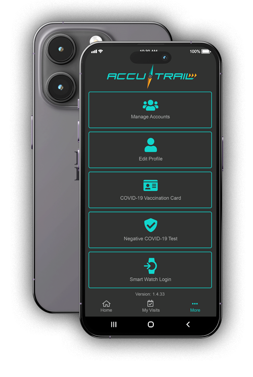
The Self-Assessment Tool (SAT) is designed to empower citizens, businesses, and municipalities to digitally report property damages following emergencies or disasters. By leveraging georeferenced online reporting, SAT enables government agencies at the municipal, state, and federal levels to rapidly collect, analyse, and visualize field-verified information to support situational awareness and response operations.
The Self-Assessment Tool (SAT) is designed to empower citizens, businesses, and municipalities to digitally report property damages following emergencies or disasters. By leveraging georeferenced online reporting, SAT enables government agencies at the municipal, state, and federal levels to rapidly collect, analyse, and visualize field-verified information to support situational awareness and response operations.


Proprietary Data-Sets
TrackIt, LLC provides mapping and visualization services, creating interactive and informative maps for a wide range of applications. We are proud to own and deliver proprietary data layers that surpass any other Puerto Rico geo-address repository in existence. This is the result of decades of manual curating and updating by our field data collection experts supported by clever proprietary AI GIS algorithms.

ALLIANCES
